
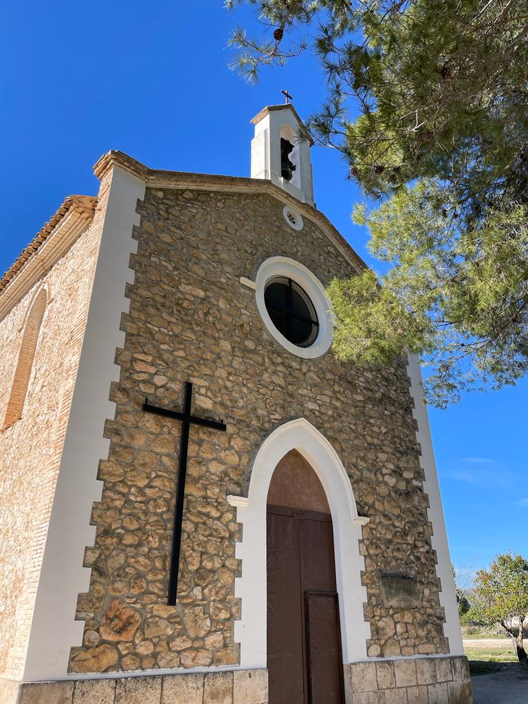
The stage begins at Fuente de la Morera which is just off the local road CV655 and about 12 km from Ontinyent. Nearby there is a Hermitage / Ermita of the same name. It is really a full-blown church. Below is a photo (and a video) of the place as it is quite interesting.
Fuente de la Morera is located in an area called the Vall d’Albaida which is an area covering about 722 square kilometres. There are large vineyards in this area. One of the local bodegas “Rafa Cambra” produces very fine red wines. The name of the area is derived from the Hispano-Arabic word albáyḍa, which in turn is derived from the classical Arabic البيضاء (al-baīḑà’, “The white one” which makes reference to the white chalk land).
The walk starts by crossing the road (CV655) from Fuente de la Morera and walking across a flat plain full of vines. You will walk through/past Finca San Agustín. The walking is easy until you hit another local road CV660. You cross the road and after a while you will start ascending a very steep path (just after passing the small amateur bullring and a rather cute small stone house) strewn with scree. It is about 15 minutes up the scree so not very long but not great for walking. Eventually, after the path has become narrower and a more normal kind of path along a ridge, you will come across a rudimentary concrete cross close to the trail along which we ascend. You will continue to go up with excellent views of the valley (Vall d’Albaida).
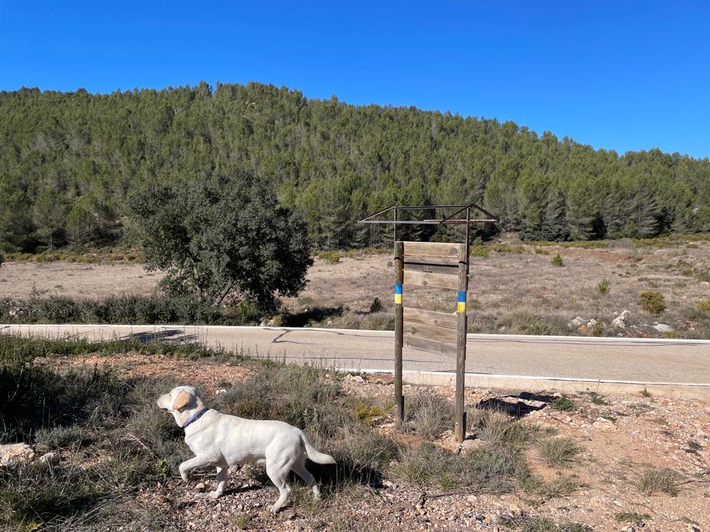
Once you have got to the summit (Alt de les Figueroles, 836m), you will have walked 6,8 km from Fuente de la Morera and ascended from 480m to 836m. The actual climb begins at 3 km from Fuente de la Morera. Up to that point, you will have been walking along a flat, easy path. Once at the top, you will descend a path which is more like an unsurfaced road so you can walk really fast. I sometimes go into military mode in these situations, and I motor along these kinds of tracks. However, this does not last for long before you have to turn off this wide path and practically go cross country through shrub. The path is not at all clear but if you follow my trail on Wikiloc you should have no problems and will eventually arrive at the end of this stage on the local road CV651 between Vallada and Moixent, where there is curiously enough a signpost painted with the Ukrainian flag. A sign of the times!
I should say a word or two about Wikiloc which I highly recommend. I have used other software for my walks such as ViewRanger (now, I think, Outdooractive) and Strava but Wikiloc is the most intuitive app and suits my purpose. It is also cheap (premium subscription is at 10$ per year). To read the trails, you should either download the free version of Wikiloc or GPX viewer (an offline vector maps app). My impression so far is that the quality of trail marking varies tremendously. The trail markers are there, in fact, in the most remote places. However, those subtle left or right turns are not always clearly signposted. Following my trails on Wikiloc, I don’t think you will get lost. If you want to hike the GR 7 (which is the route I am doing now) in Spain, I highly recommend bringing a GPS with the relevant gpx tracks. I would not be able to hike the trail without it. I have been told to have a paper backup by some friends, but I haven’t needed it so far. If you want a place to go to for maps on Spain (including paper maps), you should go to:
https://www.ign.es/web/ign/portal
You can check out the route here:

Leave a comment